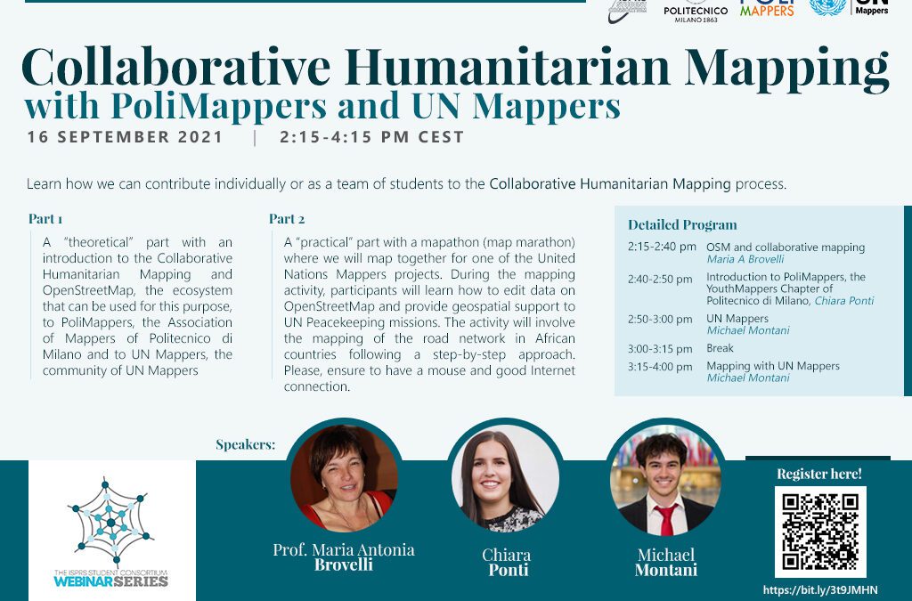
by admin | Sep 8, 2021
The webinar consists of two parts: 1) a “theoretical” part with an introduction to the Collaborative Humanitarian Mapping and OpenStreetMap, the ecosystem that can be used for this purpose, to PoliMappers, the Association of Mappers of Politecnico di Milano and to UN...
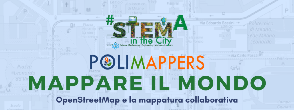
by admin | Apr 21, 2021
The event introduces to High Schools, the topic of collaborative mapping, presenting OpenStreetMap and some applications in the humanitarian and accademic field. The project comes from PoliMappers, a group composed by voluntary students from Politecnico di Milano in...
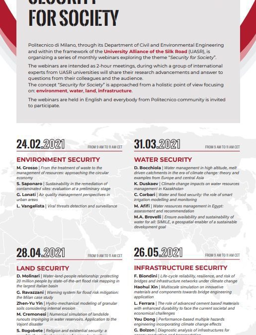
by admin | Apr 20, 2021
Protecting physical and cultural territories is the key topic of this session, devoted to a recall of mapping, monitoring and modelling tools supporting warning systems and risk prevention and mitigation measures in different potentially harmful situations. The...