Geological and Hydrogeological Hazard Management
The research line is part of the departmental macro-thematic concerning “NATURAL, ENVIRONMENTAL AND TERRITORY SYSTEMS”, i.e. “Geological and hydrogeological risk”. In particular, the group develops methods and models for the prediction, prevention and management of risks related to slope landslides and their interaction with surface and groundwater, including the development of innovative and low-cost monitoring techniques and emergency management, but also geological risks related to the construction of structures and infrastructure, with particular reference to the quantification of drainage processes operated by underground works. With regard to slope landslides, research focuses on Civil Protection issues, with reference to both Forecasting and Prevention and Risk Management activities. In this sense, the research was first of all aimed at defining methodologies for geological and hydrogeological risk mapping, with reference to the different types of kinematics (from collapse landslides to debris flows to complex kinematics), including piping phenomena.
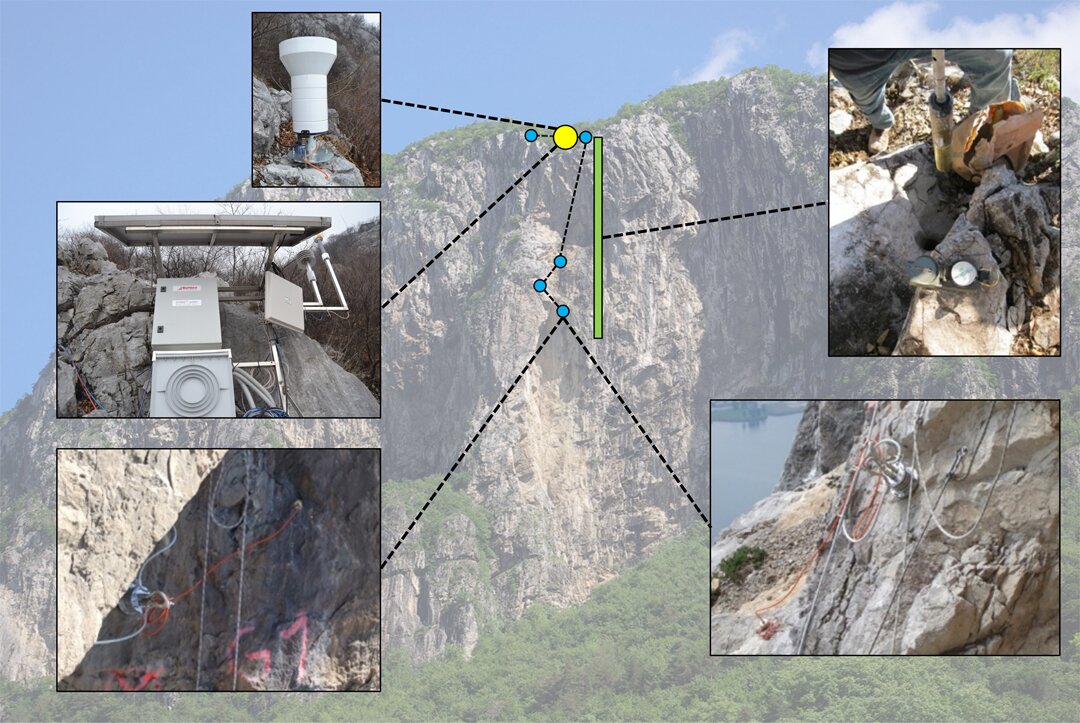
In the field of forecasting and prevention, research focuses on conceptual and numerical modelling of unstable slopes, and in particular on the effects produced by groundwater circulation on stability conditions (hydrogeological susceptibility to landslides), as well as the scale effects associated with numerical modelling and the identification of the optimal amount of information. For collapse landslides, particular attention has been devoted to the design and installation of experimental passive seismic monitoring networks, with automated data collection and processing and the evaluation of the effects of rainfall, thawing cycles and cryoclasm. Also in the area of landslides, the use of optical fibres is being experimented for monitoring hydrogeological instability using low cost interrogations. The objective is to identify precursor signals of instability in surface landslides.
The activity is carried out both in field and in the GAP2 Laboratory of Politecnico di Milano, where a franometer has been realized to simulate surface landslide events. As regards slope erosion and solid transport in the riverbed, semi-automatic distributed models based on GIS logic were implemented to assess the impact of diffuse and concentrated phenomena, with integration between slope and riverbed processes and experimentation of innovative measurement tools developed in collaboration with ISS technology, start-up of the Politecnico di Milano. Referring to risk assessment associated with underground works, the research has focused on the assessment of geological and hydrogeological risk for design purposes, with particular reference to the interactions between groundwater and underground works in urban areas, as well as the forecasting of water flows in tunnels, particularly in carbonate rock masses. In addition, methodologies have been studied to reduce the hydrogeological and geological risk in tunnels by using innovative approaches and numerical models to reconstruct the tensa-deformative state of the rock masses. These methodologies have been applied to disused mines, which represent a real civil protection problem.