Hydrogeological risk and weather and climate drivers:
assessment and management
This line of research contributes to the key research area of the Department: Natural systems, environment and land planning – Risk geological and hydro-geological. This area of research develops the activities provided for in the European Directive 2007/60, based on historical experience in the field of physical and probabilistic hydrology, of the hydrological and civil protection extremes, with a view to adapting to climate change. The activities carried out focus on the study of:
(i) flood risks;
(ii) exposure to damage and the relative vulnerability of people, urban infrastructure and production systems;
(iii) risk management and mitigation through the synergy of structures and non-structural interventions.
In particular, the following topics are developed
- uni/multivariate probabilistic analysis of hydrological extremes for the design of hydraulic works and systems;
- flooding areas and damage assessment: hydraulic-hydrological modelling procedures and use of satellite data;
- field monitoring, through the development of methods for direct observation of the process, including innovative techniques for the measurement and assimilation of remote sensing, satellite, meteorological radar, lidar and ground data;
- models for assessing the impact of climate and anthropogenic forcing on hydrogeological risk at different spatial scales;
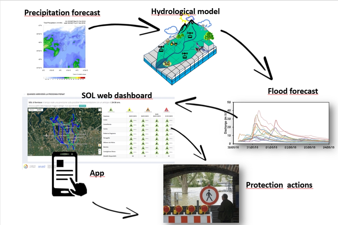
- models for the prediction, development, calibration and validation of real-time simulation algorithms for forecasting, alert and warning procedures;
- mathematical modeling of flash floods, debris flows, fire, surface landslides, tree debris;
- climatic and anthropogenic forcing agents, effects on residual risk of dams, river containment structures, flood lamination areas;
- the development of hydraulic risk management activities under European Directive 2007/60;
- real-time flood forecasts with hydraulic meteorological models and assimilation of satellite data;
- integrated risk management based on spatial planning and civil protection standards;
- design of structural and non-structural mitigation systems, cost-benefit analysis.